Tracking the impact of mining from space
Mines change landscapes over the course of years. Researchers from Freiberg have developed a method designed to make such changes visible using satellite data. It was tested at six mines around the world.
Read Aloud
0:00
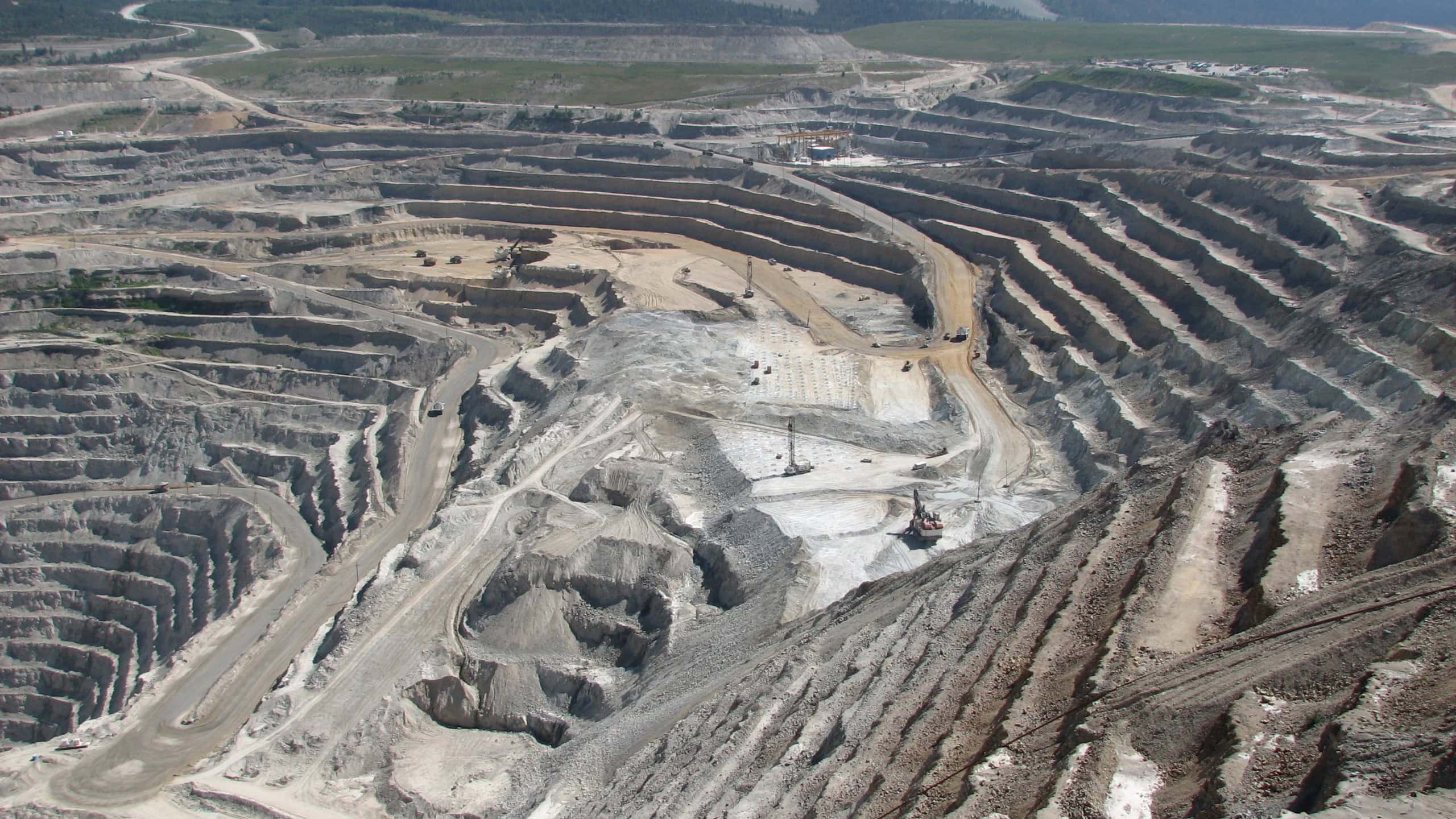
Mining alters landscapes on a large scale. Researchers from Freiberg are investigating how such changes can be monitored using satellite data. © JacquieS/pixabay
The smartphone in your pocket, the electric car outside your door, the wind turbine on the horizon. None of these things would work without metals. They are mined all over the world. This leaves its mark on nature. The extent of mining’s global land footprint and how it has changed over the years has so far been inadequately documented. A team from Freiberg wants to change that.
The researchers are based at the Helmholtz Institute Freiberg for Resource Technology (HIF) at the Helmholtz Center Dresden-Rossendorf (HZDR). They have developed a method designed to track changes around mines using satellite imagery.
A closer look at the plants
The method is called SHABA and analyzes satellite images. It focuses on the vegetation surrounding a mine. However, the plant life changes even in the absence of mining. Trees lose their leaves, plants bloom, and dry spells turn areas brown.
SHABA takes such seasonal fluctuations into account and also compares the data with previous years.
“This allows us to reliably detect changes in vegetation with SHABA and pinpoint them precisely in space and time,” says Vincent E. Nwazelibe, the study’s lead author.
Six mines, 25 years of satellite images
The team tested SHABA at six mines on different continents and in various climate zones. They analyzed satellite images from 2000 to 2025 – more than a hundred per year for each site. The study examined vegetation within a radius of up to 100 kilometers. “The vegetation data from the satellite images are converted into a clear wave diagram using SHABA. This makes it easy to see when the vegetation at a specific location has changed and by how much,” says Dr. Samuel Thiele, group leader at the HIF.
However, the satellite data alone does not reveal what caused a change. Especially outside the actual mining areas, other factors can also play a role. In the study, the researchers therefore compared the changes they found with known developments at the respective sites. For example, vegetation loss was observed where areas had been cleared for mine expansion or to build an access road. In other places, vegetation increased again as a result of reclamation.
So far, SHABA has been tested at six mine sites. The researchers plan to use the method in the future to document changes at mines worldwide. Further studies are needed to determine whether it works equally well across a wide variety of mines and landscapes. The data collected will be made freely available. SHABA itself is already freely available.
Original publication:
V. E. Nwazelibe, M. Kirsch, S. T. Thiele, F. Djeddaoui, W. Yu, R. Gloaguen, R. Tolosana-Delgado, “Monitoring mining impacts using harmonic decomposition of time series vegetation indices,” in ISPRS Journal of Photogrammetry and Remote Sensing, 2026